
Browser Based
No installation
Geotag photos online with accurate GPS coordinates, a map, address, date and time. A fast browser-based geotag photo editor for work, travel and inspections.

No installation
Your data stays with you
Start immediately
Real GPS metadata

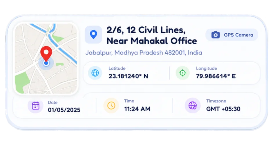
GPS Camera automatically captures and overlays your location, map thumbnail, address, date and time—so you always have trusted, share-ready proof.
Captures precise location with every photo.
Instant mini map preview of your location.
Automatic timestamp with timezone.
Perfect for reports, inspections and audits.

Take a photo or upload from your gallery.
Get GPS automatically or choose on the map.

Add template, project name and other details.

Download your geotagged photo instantly.
GPS Camera combines the speed of an online geotag photo editor with clear map and timestamp details, so each exported photo is easier to organise, verify and share.
Photo geotagging connects an image with a real-world location. A geo tag can include latitude, longitude and address data, while a visible GPS stamp can also show a map, date and time directly on the photo.
EXIF GPS metadata stores coordinates inside a supported image file. A visible map or timestamp stamp makes the same location context easy to read in reports, messages and inspection records.
A GPS map camera is useful for construction sites, field surveys, property visits, deliveries, travel logs and any workflow that needs a photo with clear location and time context.
A GPS map camera captures a photo with location details such as latitude, longitude, address, map context, date and time.
Open the GPS Camera tool, allow camera and location permission, review the live location details, then capture and download the photo.
Yes. The GPS Camera tool is free to open in your browser and does not require an account.
Yes. Use the Geo Tagging Tool to upload an existing image, add GPS coordinates, location, date, time and title, then download the tagged copy.
GPS Camera is for capturing a new photo with live location details. Geo tagging is for adding location metadata to an existing photo.
Yes. A modern phone browser can request location permission and provide coordinates when GPS or location services are available.
Yes. The tools are browser based, so they can work on modern Android and iPhone browsers with camera, file and location permissions.
No. The tools are designed to process photos in your browser. Your photos stay on your device unless you choose to share them elsewhere.
The Geo Tagging Tool supports JPG, JPEG, PNG and WEBP uploads. Metadata support can vary by file format and browser.
After adding tags, use the details view in the Geo Tagging Tool to review the saved location, coordinates, date, time and title.